02746 is zip code located in New Bedford, Massachusetts. The population is 14,345, making 02746 the 3rd largest zipcode in New Bedford.
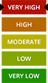
There are 4 public schools in 02746 with an average Homefacts rating of C-. The total crime rate for New Bedford is moderate , and there are 33 registered sex offenders residing in the zip code 02746. Unemployment in 02746 is high.
Zip codes within New Bedford include 02740, 02741 and 02742.